“You’re going to freeze.”
“Do you have any idea what you’re doing?!”
“Don’t bother, everything will be closed.”
When I told people I was going to trek the Annapurna circuit in January, the responses were universally negative. Winter, I was told, would make completing it practically impossible.
My parents had completed the circuit 20-odd years ago when they were dating, and swore to return with their children in the future. With my little brother finally being old enough to carry his own pack, it was decided that 2017 was the year they would return to Nepal. Of course, being Australians, the most convenient time for us to travel is during our Summer holidays, in January.
Having stocked up on warm clothes in Thamel, we set out from Besi Sahar to trek. The scenery was unexpected—things felt more lush and tropical than icy.
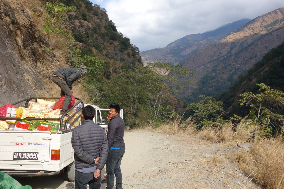
We took a local jeep for an hour or so to get a head start. It’s possible to get a lift all the way to Manang, at the top of the circuit, but you’d miss out on so much by taking it. Plus the road is petrifying.
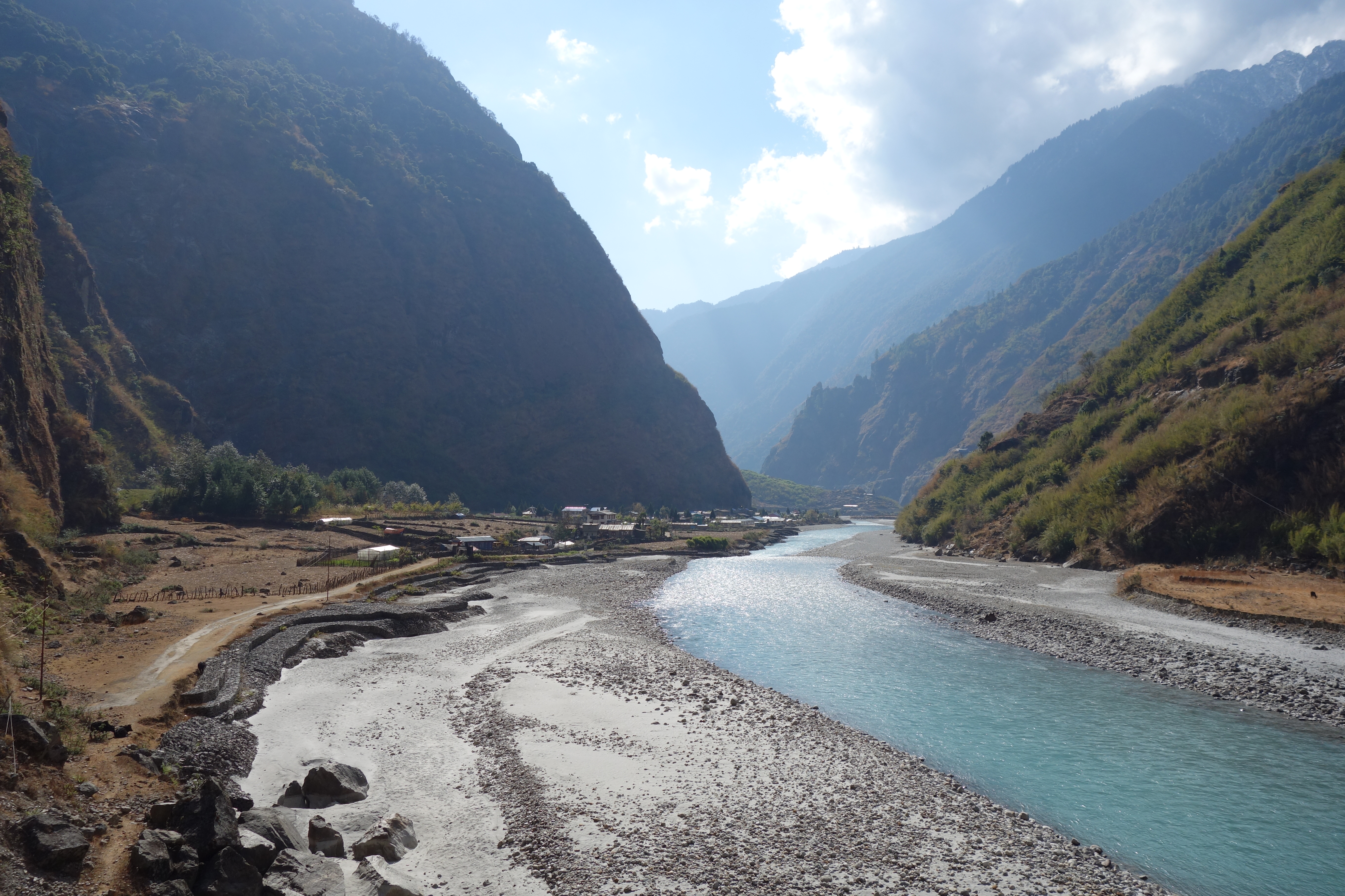
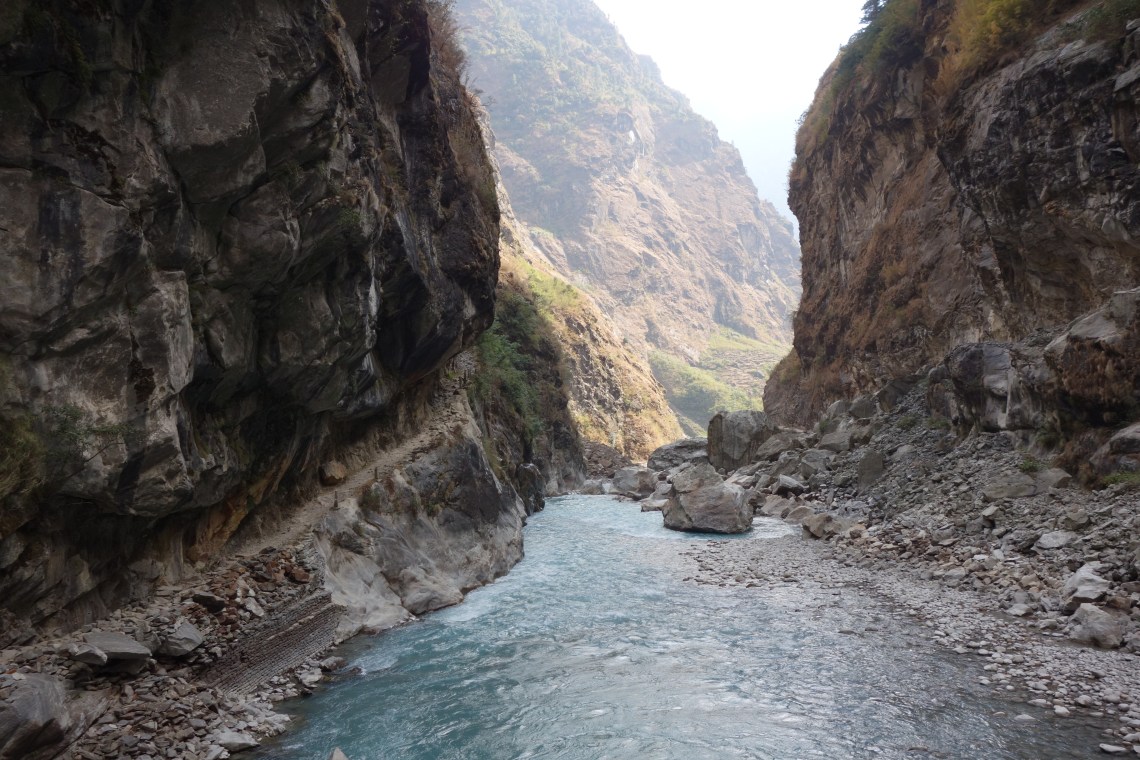
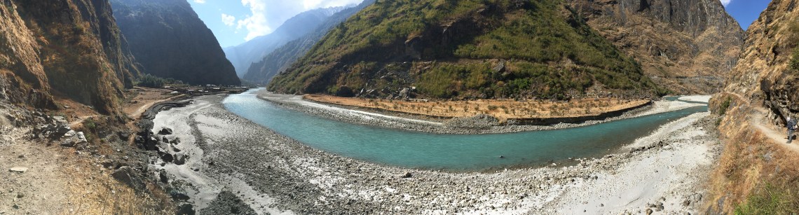
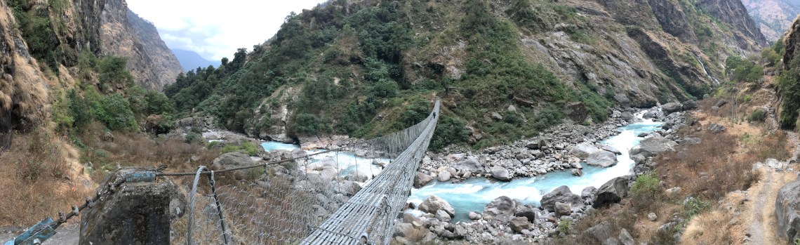
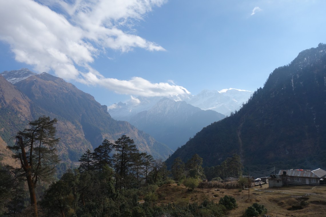
The circuit follows a series of valleys, zigzagging from one side of the river to the other. You’ll cross Nepal’s iconic suspension bridges as well as more makeshift wooden ones. In this part to the circuit, you’ll fall asleep most nights to the sound of the river crashing below you. The ferocity of it is a stark contrast to the serene conditions of the rest of the valley.
Such was the case in Syange, where the cacophony of the rapids reverberated up either side of the valley. The small town is flanked by what would become two recurring sights on the trek: a suspension bridge and a small hydroelectric power station.
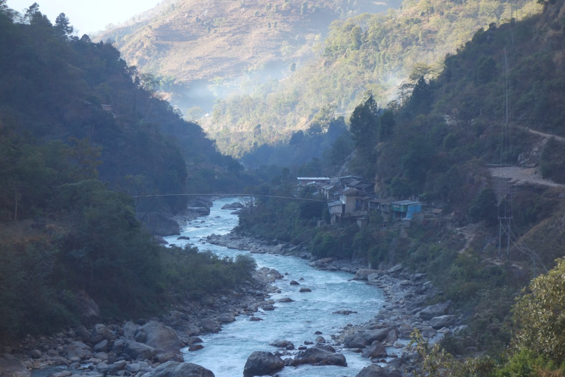
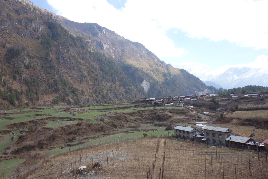
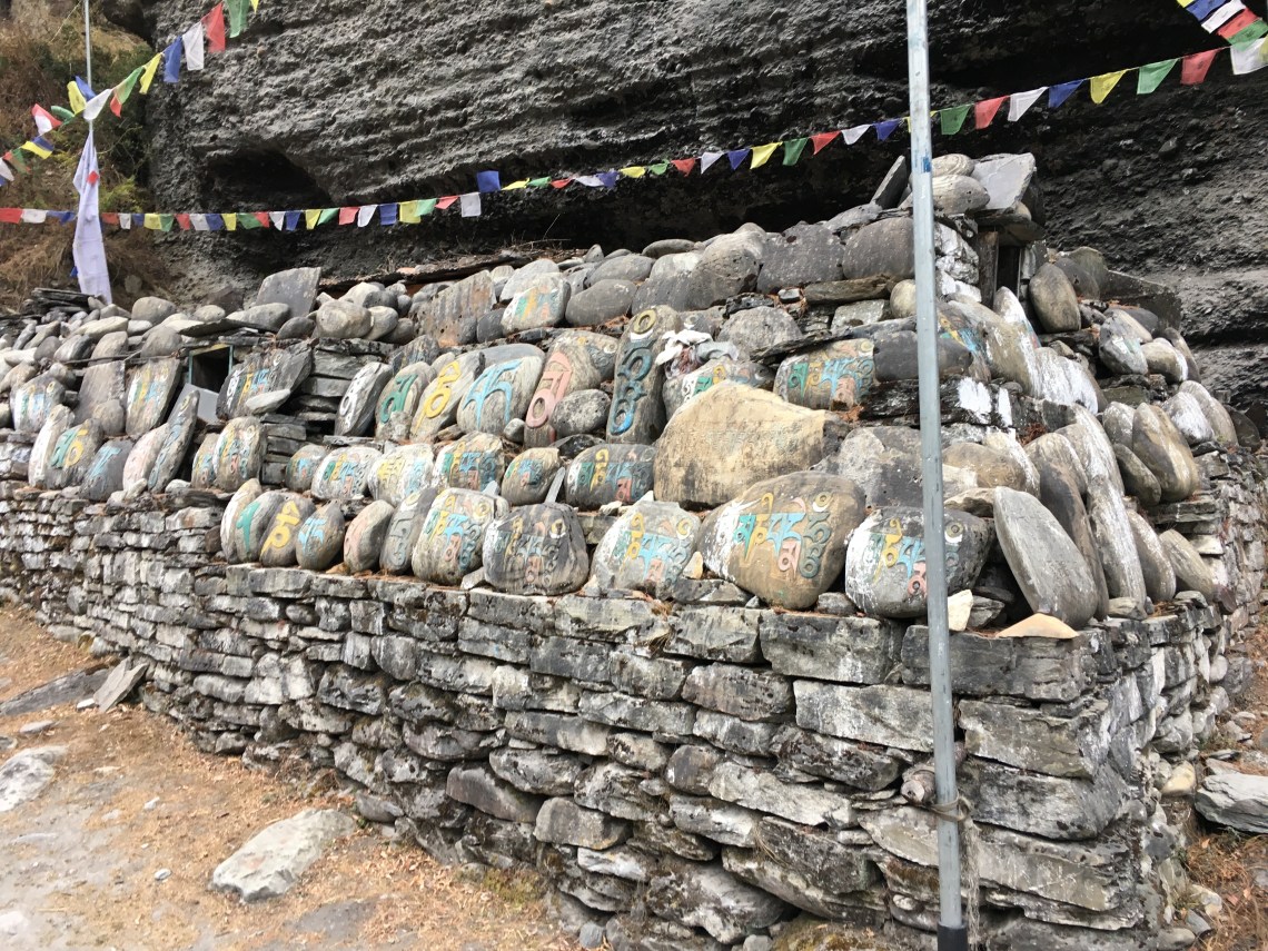
After several identical towns perched by the river, the valley opens up at Lake Tal. As usual, we staye’d in a family-run teahouse. Here we were awoken to the soft chants of the father’s Tibetan prayers. Mani walls become more common, and prayer flags are strewn liberally.
Although Nepal is a predominately Hindu country, the Manang Region where the Annapurna Circuit meanders is overwhelmingly Buddhist. This is due to the large Tibetan population, many of whom are decedents of refugees from what’s now China.
Because of this, mani walls abound. Remember to spin the prayer wheels on the mani walls from the left-hand side and always clockwise. Some of the walls feature ornately-carved, wooden wheels, whereas others use old coffee tins. Both are beautiful in their own way.


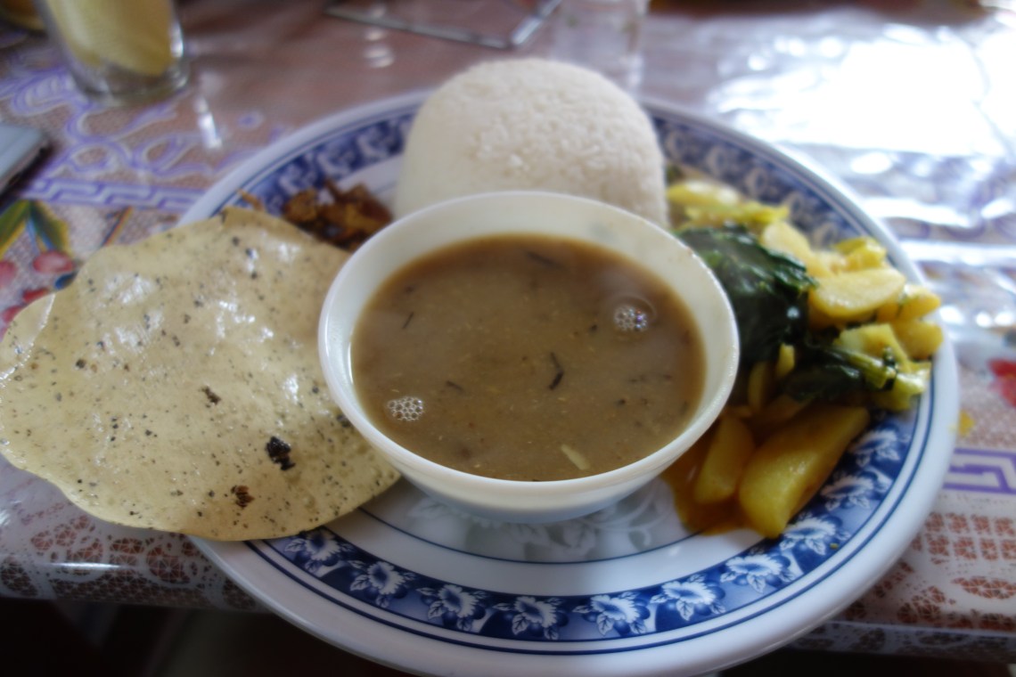
Food, however, is no different from the rest of Nepal. Each teahouse (the local form of accommodation) features an identical menu so that locals don’t resort to selling their own food supply in a bid to outdo one another and attract more guests. There are a bunch of, well, unique takes on Western staples, but expect to eat a whole lot of daal bhat.
The daal bhat is actually the best choice too. It’s traditional home cooking, with fresh local ingredients. This is a place where food reflects the geography. Crops and cattle are farmed according to both topography ant altitude, and you can taste this in every meal you eat.
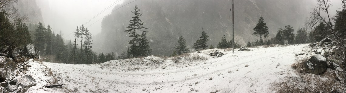
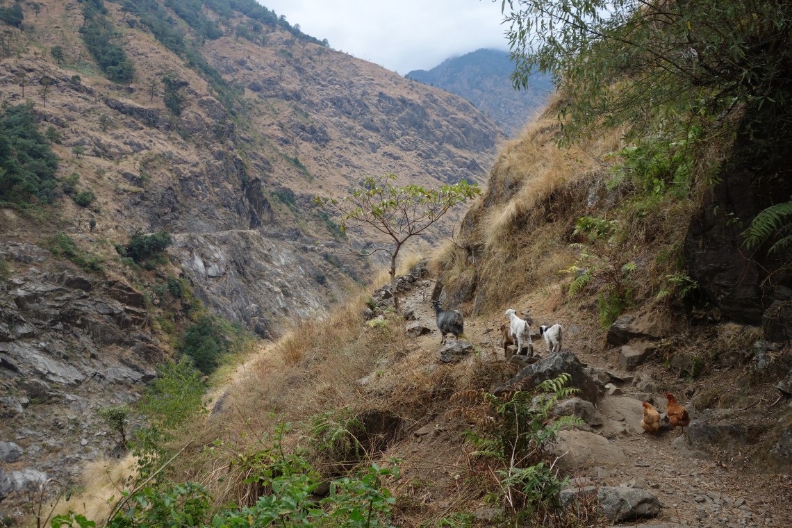
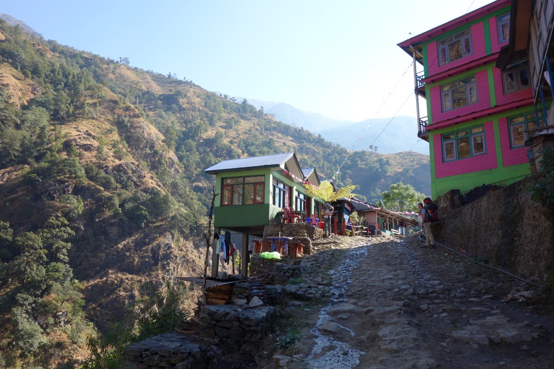
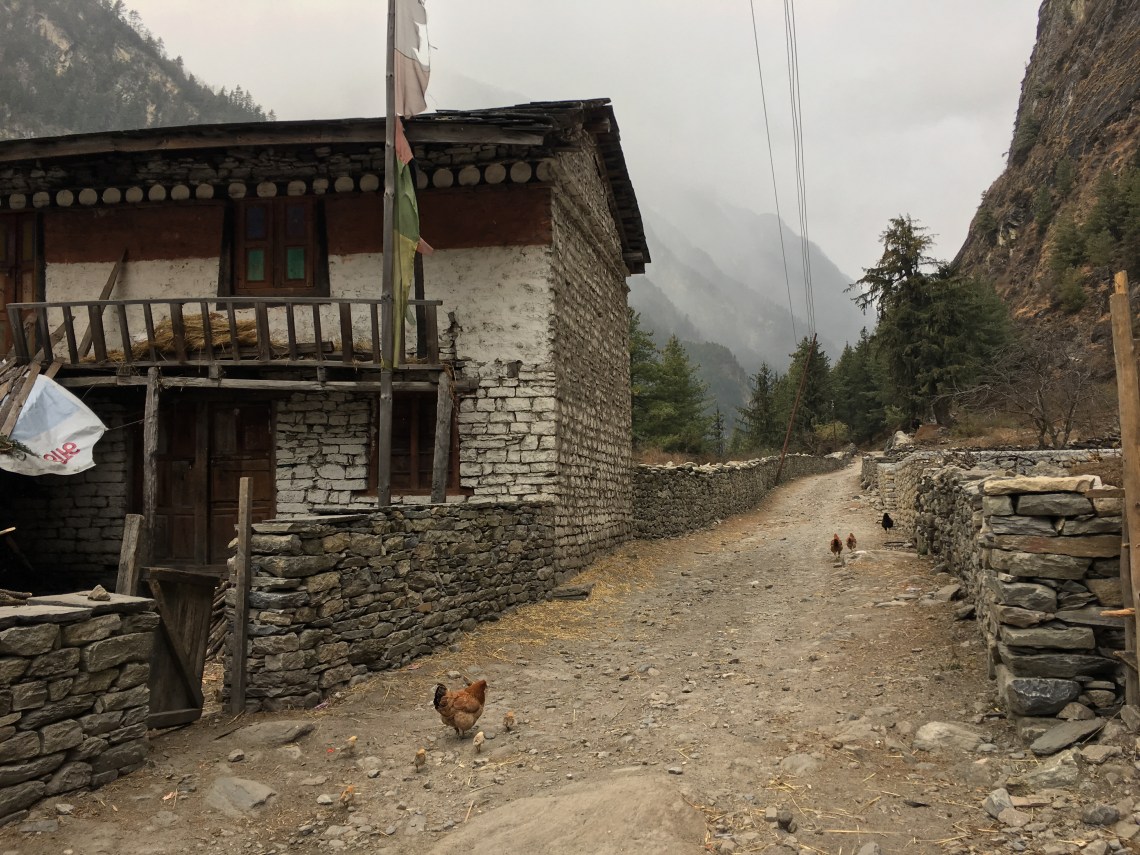
As the track continues, it begins to grain height and cling to cliffs. When we reach Timang, snow starts to fall on us for the first time. Timang, like many of the towns we stayed at, seemed to be mostly empty. During the winter, the low season, most workers in the tourism industry go back home. The only people who remain are actual locals, meaning just a couple of family-run teahouses are actually open in each town.
You’ll have the whole place to yourself, and because of this, many teahouse proprietors will offer you free beds so long as you eat all your meals there. This is in no way an inconvenience, as there are no restaurants and you can’t really eat at another teahouse (which would have an identical menu anyway). Typically, the price for accommodation is mostly nominal and food is how the teahouses make all their money, and as a family of four, people were particularly eager to have four empty bellies stay the night.
Having learned this lesson from our disappointing night in Timang (where we stayed in the one non-family-run teahouse), we set out for a long day ahead. While having lunch at Chame, by far the area’s largest and most important town, locals would ask us about our plans. We explained that we’d use the afternoon to make it to the next town. Everyone’s reaction was the same: there are no beds there, you should stay put in Chame (preferably in their own teahouse) instead.
In almost every other country we’d been to, if someone approaches you and tells you the place you want to visit is “closed”, “no good”, or “too far away”, it’s almost certainly a ruse to get you into their own restaurant/attraction/accommodation. With this in mind, we soldiered on after lunch despite the drizzle that had just start to set in.
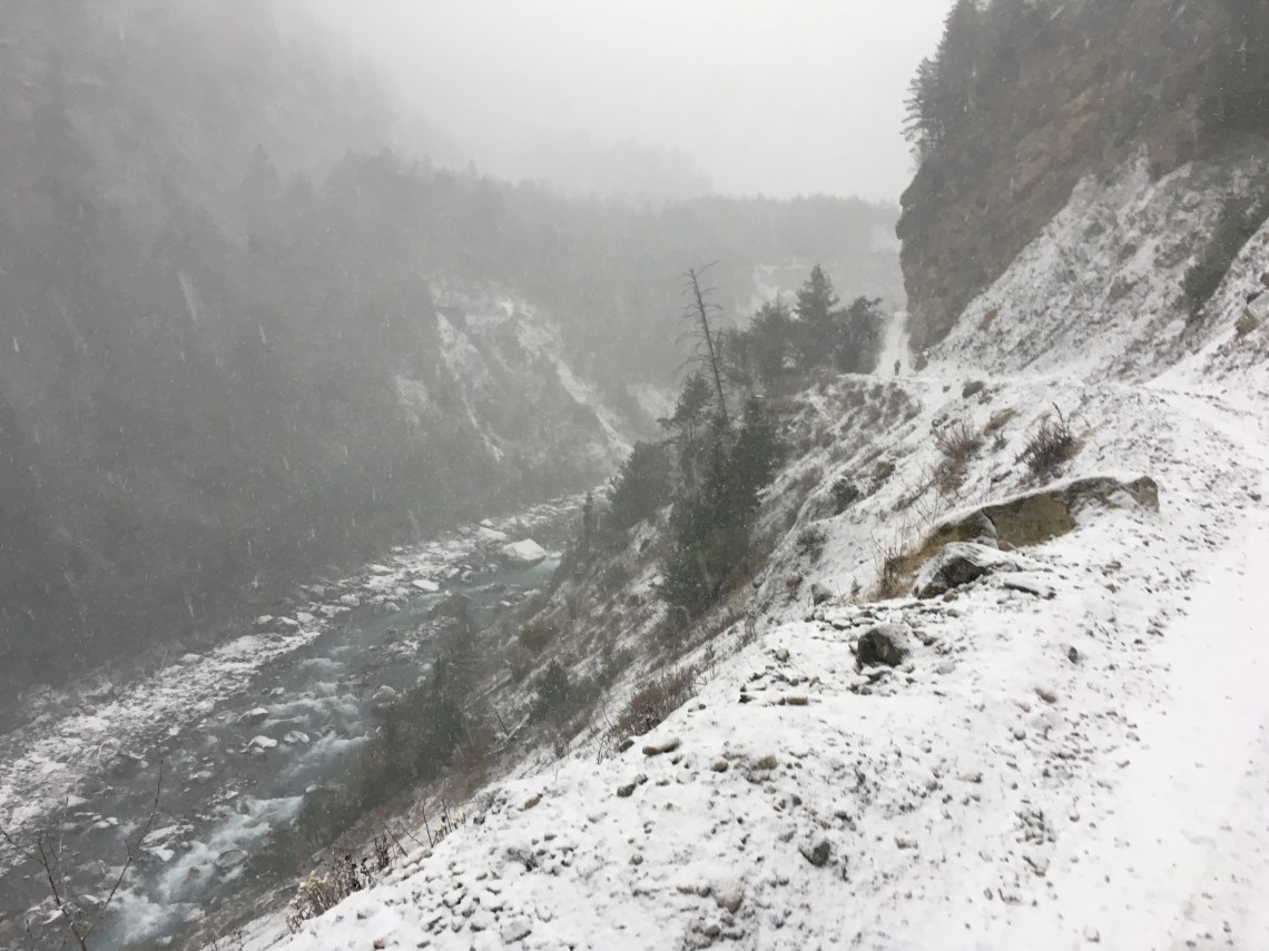
Crossing the river from Chame, the forest becomes dense, but not enough to provide shelter from the rain, which was gradually getting heavier. As the sun lowered, the temperature cooled and the rain drops began to turn into snowflakes—a great experience for a bunch of snow virgins from Australia.
The next town is called Bhratang. According to our Lonely Planet trekking guidebook it has plenty of teahouses and is a decent place to spend the night. Our trekking map, which was the most recent edition with the most detailed scale we could find in Kathmandu, also noted the town as having teahouses and other trekkers’ facilities. But print does not update as quickly as the world it attempts to describe changes.
Approaching the town, we begin to see high wooden fences and watchtowers. These turn out to be unusually-fortified apple orchards. There was just a single building left in the town: an hold teahouse used to accommodate the fruit pickers and builders. Every other property had been demolished by a very wealthy local business man who had converted the entire town into an apple plantation. Across from this building was an under-construction chalet, which would perhaps one day price gauge helpless tourists who had no other place to stay. Such as ourselves.
So we continued on, just as it went dark. The track suddenly became steeper, and the snow started falling much more heavily. The lack of visibility was so disorienting that we couldn’t even locate ourselves on the map. We were tired, hungry, and worst of all, lost. After two hours of pitch-black, freezing-cold trekking, we finally wound up in the next valley in the town of Dhikur Pokhari, which had ample accommodation.
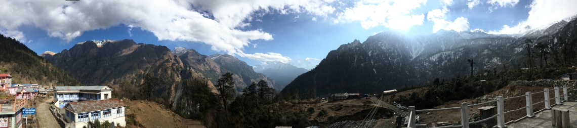
The backdrop for Dhikur Pokhari is the mountain of Paungda Danda. It’s known locally as Swarga Dwar, meaning the Gateway to Heaven, due to locals’ belief that spirits must climb the wall to enter heaven. But for outsiders, the mountain is spectacular for its smooth, bowl shape–the product of a lakebed being uplifted when the Himalayas were formed.
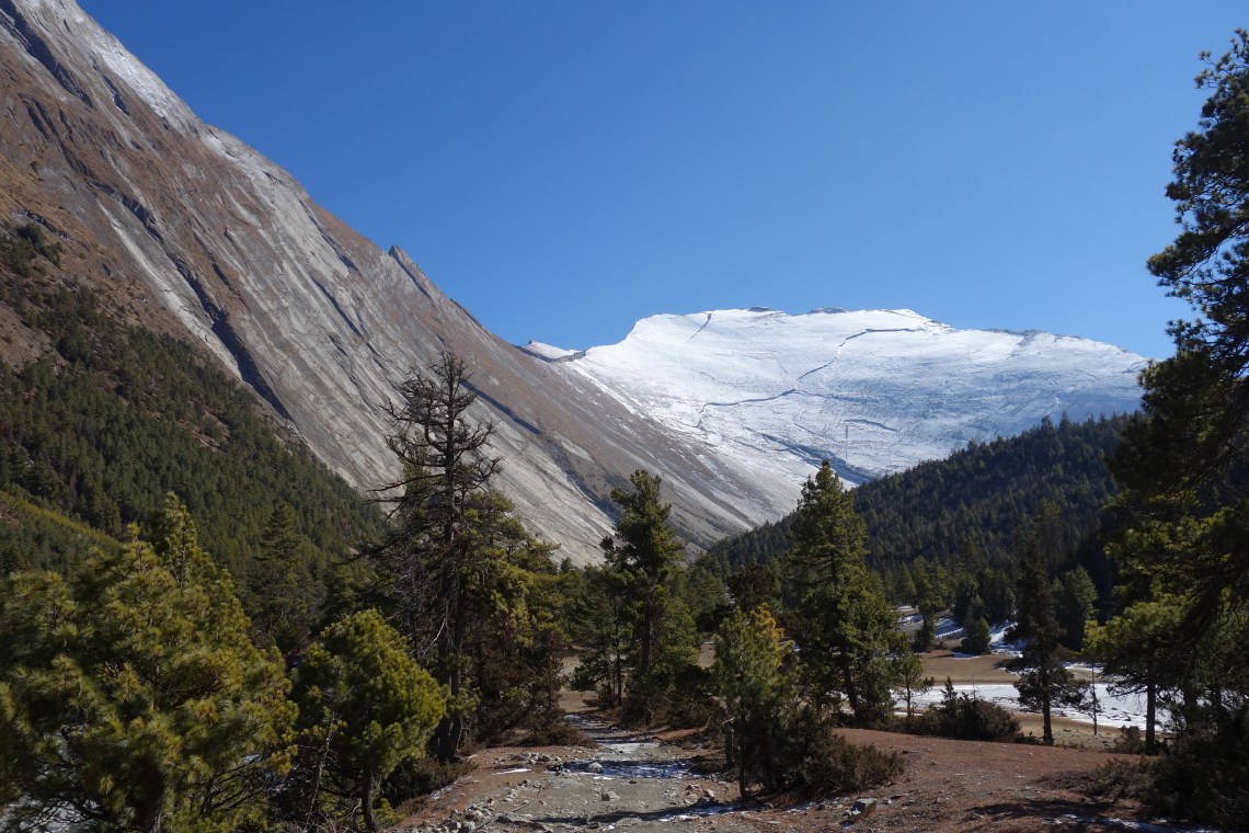
This mountain marks a turning point. Firstly, you enter another valley which is much wider. This allows for fields and forests while previously it was just the river and rocky cliffs. But more importantly, the track begins to gain altitude. And that magical leg of the trek is saved for Part 2 of this post.


The trek from Chame to Dhikur Pokhari sounds particularly terrifying, especially when you realized that there’s nothing in Bhratang. I’m glad you all made it! But when you thought you were lost, what were you thinking? Did you decide to keep walking anyway, or did it cross your mind to go back to Chame?
LikeLike
I was with my family, and my mum was not at all pleased with the situation haha. But it never occurred to any of us to do anything other than continue forward. Backtracking to Chame and then coming back in the morning would be pretty demoralising, and we knew we’d track the next town eventuallyyyyy
LikeLiked by 1 person
Wow! Such stunning landscapes! We’ve never been to Nepal, but would like to visit someday (but first Australia though! haha) It might have been cold, but in the end it was a good idea to visit in January though, because you got to beat the crowd and see snow during (your) summer. Although, I must say that the whole region looks quite rural… Love the view from your window! 🙂
LikeLike
Yep, we sure beat the crowds and it was still sunny too! It wasn’t the warmest of times but I’d definitely recommend January as a time to visit!
LikeLike
I done the trek to Everest Base Camp and loved it so much. I loved everything about the area and the people. I really want to go back and do the Annapurna circuit. If anything your post makes me want to go even more now. Cool that it follows the Marshyangdi River especially as it is so pretty.
LikeLike
Likewise, I’d love to go back and do the Everest Base Camp trek. Or maybe the Indigenous Peoples Trail. Regardless, there are so many incredible treks to choose from that I could easily keep on coming back to Nepal!
LikeLike
Corrections:
Chame is in the Manang District (it is the administrative centre of Manang), not Mustang (which is on the other side of the Thorung La)
Bagarchap is before Chane (and was largely destroyed by landslide in 1995). You mean Bratang.
LikeLike
Ahh good catch on both counts! 🤦♂️ Can’t believe I got the two towns mixed up after having the name Bhratang burned into my mind forever!
LikeLike
Beautiful photos of Annapurna circuit. ☺. Haven’t trekked there since 2007 myself.
LikeLike
Thanks! Your journeys around the mountains of Afghanistan and Pakistan have had me particularly inspired!
LikeLike
We did this trek in 2011, nice to revisit it with you today. I remember all of these towns except Dhikur Pokhari and the apple orchards. We likely passed through at a different time of day and didn’t pay attention. Maggie
LikeLike
Thank you for the kind words! I think the orchards were very new at the time we passed through, hence why they weren’t mentioned in our guidebook and probably why you didn’t see them either. But it’s amazing how all the other tiny towns create lasting memories to this day.
LikeLiked by 1 person